
A Peninsula with Deep Roots
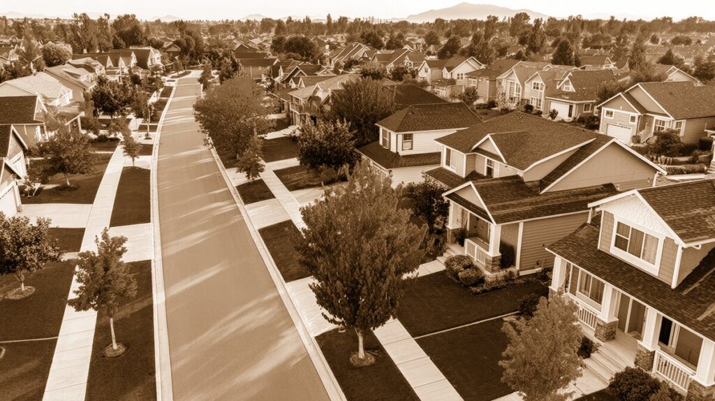
On a map, Yarrow Point looks like a small, quiet peninsula reaching into Lake Washington. In daily life, it feels much the same: a wooded residential community of winding streets, lake views, mature gardens, and neighbors who still recognize one another on a walk. Yet beneath that peaceful appearance is a history reaching back more than a century.
The first land patent in what is now Yarrow Point was issued to Wilber W. Easter on July 20, 1886. By the late 1880s, the peninsula was attracting land speculators, summer residents, farmers, and families seeking a rural setting within reach of Seattle. The area’s location on the eastern shore of Lake Washington made it scenic but initially difficult to reach, with access largely by boat or along rough roads around the lake. ([bellevuewa.gov](https://bellevuewa.gov/sites/default/files/media/pdf_document/2023/22-112187-LE%20%20Poster.pdf?utm_source=openai))
For generations before non-Indigenous settlement, the broader Lake Washington shoreline was part of the homeland and travel network of Coast Salish peoples, including the Duwamish. That earlier history is an important part of understanding the Eastside landscape, even though much of Yarrow Point’s written local history begins with late-nineteenth-century land claims and homesteads.
How Yarrow Point Got Its Name
The name “Yarrow” is generally traced to Leigh S. J. Hunt, a prominent Seattle businessman and publisher of the *Seattle Post-Intelligencer*. In 1888, Hunt acquired much of the peninsula and established a large lakeside estate called “Yarrow.” Over time, the estate’s name became associated with the entire point. ([yarrowpointwa.gov](https://yarrowpointwa.gov/wp-content/uploads/2024/12/2024-Comprehensive-Plan.pdf?utm_source=openai))
The name may have been inspired by the River Yarrow in Scotland and its appearance in the poetry of William Wordsworth. That literary and Scottish connection fits neatly with the neighborhood’s later street names. When George F. Meacham laid out an early development plan in 1907, he sponsored a contest inviting Scottish-themed names for the streets. Today, names such as Sunnybrae, Bonneybrae, Mossgiel, Loch Lane, and Haddin Way still offer reminders of that early vision. ([historylink.org](https://www.historylink.org/file/4212?utm_source=openai))
These names are more than charming curiosities. They preserve the character of a place that was once marketed as a country retreat—a rural peninsula where residents could enjoy gardens, orchards, fresh air, and the lake while remaining close to the growing communities of Bellevue and Seattle.
Farms, Holly Groves, and Early Families
During the first half of the twentieth century, Yarrow Point was far more agricultural than suburban. Small farms and gardens produced strawberries, vegetables, and ornamental plants across the community’s roughly 231 acres. One of the most notable agricultural enterprises belonged to Edward Tremper, who purchased land in 1902 and imported English holly. By the 1920s, his operation had become the largest holly farm in the United States. ([historylink.org](https://www.historylink.org/file/4212?utm_source=openai))
Japanese American farmers and farmworkers played an important role in this period. They worked for Tremper and leased land for growing strawberries and vegetables. The forced incarceration of Japanese Americans during World War II disrupted these families and farms, and only a small number of former residents returned to the Eastside afterward. Remembering this history adds depth to the familiar story of Yarrow Point as a picturesque garden community.
Other early residents came for the health and quiet of the countryside. Samuel Curtiss Foster and his wife, Harriett, established a homestead on the Point and built a cabin in 1910. Their property stretched from 92nd Avenue NE toward 94th Avenue NE, and three generations of the Foster family lived there between 1910 and 1983. Curtiss Foster also moved his Seattle plumbing business to the Eastside, contributing practical craftsmanship to early homes and public buildings in Bellevue and Kirkland. ([historylink.org](https://www.historylink.org/file/4212?utm_source=openai))
The Lake Washington Ship Canal Changes the Shoreline
One of the most important regional milestones came in 1916, when the Hiram M. Chittenden Locks and Lake Washington Ship Canal opened. Lowering Lake Washington by approximately nine feet reshaped shorelines throughout the region. Around Yarrow Point, the change exposed additional shoreline along Yarrow Bay and helped form wetland habitat that later became valuable for wildlife. ([yarrowpointwa.gov](https://yarrowpointwa.gov/wp-content/uploads/2024/12/2024-Comprehensive-Plan.pdf?utm_source=openai))
The wetlands are a quiet but essential part of Yarrow Point’s identity. They help explain why the community still feels green and low-density despite its proximity to downtown Bellevue, Kirkland, and State Route 520. The landscape is not simply decorative; it is the result of geology, water, farming, shoreline change, and decades of local conservation.
Meacham-Morningside Park and Town Hall
George F. Meacham left one of the most visible civic legacies in Yarrow Point. In 1913, he donated two acres for a community park. The property eventually became known as George F. Meacham-Morningside Park and later served as the site of Yarrow Point Town Hall. The current Town Hall, at 4030 95th Avenue NE, was dedicated in 1990. ([yarrowpointwa.gov](https://yarrowpointwa.gov/wp-content/uploads/2024/12/2024-Comprehensive-Plan.pdf?utm_source=openai))
Today, Morningside Park remains one of the neighborhood’s social centers. Behind Town Hall, residents gather on the grassy lawn, use the playground and sport court, and take part in seasonal community events. The park’s modern role reflects an old Yarrow Point tradition: residents working together to care for shared spaces and celebrate their small-town setting.
Other public places preserve the same connection to the water and the past:
- Road End Beach, at the end of NE 47th Street, provides a maintained shoreline, dock, and swimming access.
- The 42nd Street Launch Area offers access for kayaks and paddleboards.
- Sally’s Alley, between 94th and 95th avenues, remains a walking and biking path. Its name honors Sally, a goat that once grazed there.
- The Wetherill Nature Preserve, reached near Hunts Point by the SR 520 trail or Points Loop Trail, protects a wooded and wetland landscape between the two communities. ([yarrowpointwa.gov](https://yarrowpointwa.gov/public-spaces/?utm_source=openai))
Incorporation and the Preservation of Place
By the 1950s, suburban growth was transforming the Eastside. Bellevue incorporated in 1953 and began expanding through annexation. Yarrow Point residents faced the possibility that their peninsula could be absorbed into a larger city or reshaped by more intensive development.
Yarrow Point incorporated as a town in 1959. The decision reflected a desire to preserve local control and protect the community’s residential, wooded, and shoreline character. Since then, the town has remained small and distinctive, with a strong emphasis on wetlands, open space, neighborhood streets, and carefully managed growth. ([yarrowpointwa.gov](https://yarrowpointwa.gov/wp-content/uploads/2024/12/2024-Comprehensive-Plan.pdf?utm_source=openai))
That civic identity was strengthened by organizations such as the Yarrow Garden Club, founded in 1948. For decades, its members promoted gardening, beautified public spaces, and supported community causes. Local service groups, including the Overlake Service League, also helped residents build connections through charitable work and neighborhood projects. ([historylink.org](https://www.historylink.org/file/4212?utm_source=openai))
A Living Heritage
Yarrow Point has changed considerably since its days of holly farms, strawberry fields, cabins, and boat access. Large estates and working farms have given way to carefully landscaped homes, while modern transportation has made Seattle, Bellevue, and Kirkland nearby rather than remote. State Route 520 now passes close to the community, yet the interior streets remain notably calm.
What has endured is the relationship between people and place. The Scottish street names, the old agricultural story, the preserved wetlands, the shoreline parks, and the community traditions all contribute to Yarrow Point’s sense of continuity. A walk along 92nd Avenue NE, a visit to Morningside Park, or a quiet moment near Yarrow Bay can reveal layers of history that are easy to miss.
For longtime residents, that may be Yarrow Point’s greatest distinction. It is not simply a beautiful neighborhood beside Lake Washington. It is a community that has repeatedly chosen to remember its landscape, protect its character, and carry its heritage forward.